Ozeti Map — WARDOGS Wiki
Ozeti is a town-and-landmark navigation problem
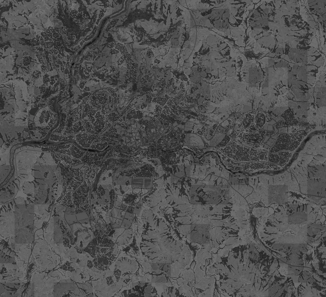
Ozeti is one of the named WARDOGS battlefield environments covered by this Wiki. The map page is designed as a terrain reference rather than a static route prescription: the randomized Control Zone means the same road, town or ridge can change importance from one match to the next.
Terrain and orientation
Hill-town terrain with a central settlement, winding roads and a sports field landmark. The central settlement and the rectangular sports field to its south are the strongest orientation landmarks. Roads fan out through the hills, so route choice matters before a squad commits to the town.
The safest way to use a fixed terrain image is to match two or more visible landmarks before making a route decision. A road junction plus a building cluster is more reliable than assuming one visual feature uniquely identifies your position.
Tower reference
The current community snapshot records 4 tower positions.
| Recorded marker | Game X | Game Y |
|---|---|---|
| Tower 1 | 95.80 | 62.82 |
| Tower 2 | 100.37 | 59.23 |
| Tower 3 | 104.49 | 63.71 |
| Tower 4 | 100.62 | 67.64 |
These positions are community-recorded and version-bound. They are reference coordinates, not live server telemetry, capture order or proof that a tower is active in the current Control Zone.
How to use Ozeti in a real match
Control Zone and support systems
The map is only the base layer. WARDOGS adds the active Control Zone, higher-value Hot Zone behavior, Towers, Drills, FOBs and vehicle routes on top of it. Those systems explain why a useful map Wiki needs more than a screenshot: players need to know which part of the terrain matters this match.
Practical map checklist
- Confirm the map name before using coordinates.
- Locate the current Control Zone.
- Match at least two terrain landmarks.
- Check whether nearby towers or support systems are relevant to the active objective.
- Choose infantry, ground transport or air transport based on distance and route.
- Re-check live terrain and markers if the community reference disagrees with the game.